Telemetric Water Monitoring System installed at Koppa-Kushalnagar Cauvery River Bridge
Kushalnagar:
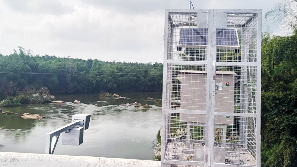
Amid the ongoing dispute between Karnataka and Tamil Nadu over the sharing of Cauvery River water, a state-of-the-art Telemetric Water Monitoring System, equipped with velocity and level sensors, has been successfully installed on a bridge across the Cauvery River at Koppa-Kushalnagar on the Kodagu-Mysuru border.
This sensor-based monitoring system offers automated and real-time data 24×7, providing precise information regarding the river’s inflow, water level, and velocity.
The system comprises two sensors: one for monitoring the speed of the water flow (velocity sensor) and another for measuring the depth of the river water (depth sensor).
The installation has been carried out by the Water Resources Development Organisation, a Central Government agency operating under the National Hydrology Project. This organisation has an Irrigation Investigation Sub-Division Office in Mysuru that is overseeing the implementation of this sensor-based water monitoring system. Each system costs Rs. 30 lakh and is imported.
A similar system has already been deployed at Bannur, where the Cauvery River flows and approvals are pending for installing two more systems on Lakshmanatheertha River (near Hunsur) and Lokapavani River in Mandya (a tributary of Cauvery).
This state-of-the-art sensor-based system provides real-time data every 15 minutes to over 15 agencies in Karnataka and at the national level, including the India Meteorological Department, Cauvery Neeravari Nigam Limited and the Karnataka State Natural Disaster Monitoring Centre.
Additionally, the data can be utilised by regulatory authorities such as the Cauvery Water Monitoring Authority (CWMA) and the Cauvery Water Regulation Committee (CWRC) to determine the water allocation between the Southern States.
Speaking to the Star of Mysore this morning, Santhosh Kumar, Assistant Executive Engineer of the Irrigation Investigation SubDivision Office, mentioned that in the past, water flow data collection was a laborious manual process.
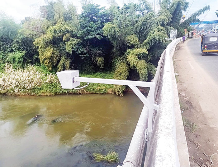
The system measures various parameters related to river level and flow, including water height from the stream bed (stream stage), river velocity (measured by a radar-based surface velocity sensor mounted above the river), and river depth and width. The collected data is then transmitted and made available for viewing and downloading.
This system is designed to monitor water levels in rivers, lakes and streams, predict the potential for flooding and issue alerts accordingly. It not only measures water levels but also assesses water velocity, improving the accuracy of risk predictions, Santhosh explained.
The system operates using solar energy and has been installed by Sun Technologies, Chennai, which is responsible for data transmission, system installation and maintenance for five years.
It may be recalled here that a Telemetric Water Gauge has already been installed at the Krishna Raja Sagar (KRS) Dam in Mandya district and at Harangi Dam in Kodagu to provide sensor-based real-time data on reservoir storage levels, inflow and outflow. These installations are part of an Online Monitoring System for the Cauvery Basin, utilising Telemetry-based Real-time Data Acquisition and Transmission.
source: http://www.starofmysore.com / Star of Mysore / Home> News / November 08th, 2023

